-
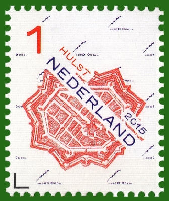
Number by catalogue: Michel: 3357A Yvert: 3283 Scott: 3203 Gibbons: 1487
Perforation: Comb Perforation type: 14 ½x14 ¼
Subject:
Non-rated stamp type "1º", suitable for sending correspondence up to 20 grams in the Netherlands. On the day of issue, the face value was 69 eurocents.
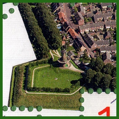
Old map of the city of Hulst*. As usual, there was a windmill in the fortified cities, and the mill remained in the modern city. It can be clearly seen in the design of the mini sheet below.
Perhaps the mill is on the map. But the plan of the modern city is completely different from the plan shown on the map. Only the city church remained unchanged. Therefore, the mill on the stamp is in doubt.
-
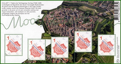
Number by catalogue: Michel: 3357AKB
Perforation: Comb Perforation type: 14 ½x14 ¼
Subject:
The mini sheet contains 5 identical stamps and is decorated with a modern bird's eye view of the city.
Small sheet like a souvenir sheet is only counted in the German catalog Michel and Dutch NVPH. In other catalogs, it is considered as a mini sheet.
Additional:
*Hulst is a municipality and city in southwestern Netherlands in the east of Zeelandic Flanders.
Hulst received city rights in the 12th century.
Hulst was captured from the Spanish in 1591 by Maurice of Orange but was recaptured by Archduke Albert in 1596.
In 1640, the Dutch forces tried to conquer the city, but they were defeated in battle by the Spanish Army, and Frederick Henry was forced to retreat.
In 1645, the Siege of Hulst (to control the left bank of the Schelde river) occurred. It was led by Prince of Orange Frederick Henry, during the Eighty Years' War (1568–1648) with Spain.
A further siege took place in 1702, where General Menno van Coehoorn defended the town successfully for the Dutch and in 1747 when it was taken by the French after incompetent defence by Lt. General Pieter de la Rocque.
In the seventeenth century, a star fort was constructed. The fortifications, constructed during that time, are historic examples of Dutch fortress architecture.
The name Hulst (Holly in English) would appear to come from the shape of the battlements.
__________
The information used was taken from Wikipedia
Size (of sheet, booklet) mm: 144x75
-
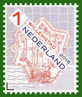
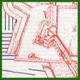
Number by catalogue: Michel: 3358A Yvert: 3284 Scott: 3204 Gibbons: 1486
Perforation: Comb Perforation type: 14 ½x14 ¼
Subject:
Old map of Willemstad *. On it you can see a windmill (see fragment).
-
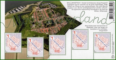
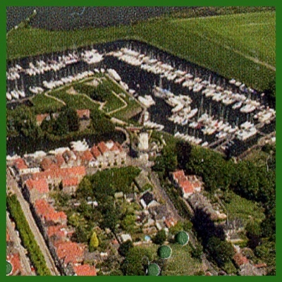
Number by catalogue: Michel: 3358AKB
Perforation type: 14 ½x14 ¼
Subject:
The mini sheet also contains 5 identical stamps and is decorated with a modern bird's eye view of the city.
Additional:
*Willemstad is a city in the Dutch province of North Brabant. It is located in the municipality of Moerdijk. Its population as of 2019 was 3,125.
Willemstad is a small historical town with well preserved fortifications. It received city rights in 1585. The Reformed Church was built in 1607 as the first new Protestant church building in the Netherlands.
Willemstad was a separate municipality until 1997, when it became part of Zevenbergen, which changed its name to Moerdijk in 1998.
__________
The information used was taken from Wikipedia
Size (of sheet, booklet) mm: 144x75
-
2015-3ss-l.jpg)
Number by catalogue: Michel: BL158 Yvert: F3283 Gibbons: MS3205
Perforation: Comb Perforation type: 14 ½x14 ¼
Subject:
The souvenir sheet contains 5 stamps with forts, published 02.02.2015 and 26.05.2015.
The sheet was decorate with fragments of small sheets, in which the stamps were issued. There are no mills on the fragments.
Size (of sheet, booklet) mm: 144x75
Beautiful Netherlands. Forts
Netherlands 2015.05.26
In issue: Stamp(s): 2 Souvenir sheet(s): 1 Sheet(s): 2
Printing: multicoloral offset
Issued in: small sheets (listed as a souvenir sheet in the Dutch catalog) of 5 stamps